But as they aged, my dad started sorting through his mementos, and when he showed me some of them it opened up a whole new window on his world. Among those relics were a few small black-and-white pictures of him canoeing with his friend, Bob Clough, in Minnesota’s north woods. They looked to be in their late teens or early twenties, young and fit and happy. I was intrigued.
This made us not just cool kid and
dorky father, but kindred spirits.
There were also receipts from outfitters in Ely and Winton, Minnesota, towns near entry points to the Boundary Waters Canoe Area Wilderness (BWCAW). They listed flour, sugar, lard and various canned goods, all in quantities sufficient for extended stays in the wilderness.
And there was this map, printed on treated canvas, of a portion of Ontario’s Quetico Provincial Park, the BWCAW’s even wilder counterpart across the border in Ontario. Hand-drawn on it was a new portage the two had blazed across the base of a long peninsula, cutting off several hours’ paddling time around it. They’d tentatively claimed it on the map with a red arrow and their last initials, C&W.
KINDRED SPIRITS
I’d known Dad was a Boy Scout, but this was something else, something more exciting than good deeds and merit badges. The guy had roughed it on his own terms, for weeks at a time, in true wilderness, back when that word meant more than it does now. A real man’s man. And, since I’d also done many BWCAW and Quetico trips myself, this made us not just cool kid and dorky father, but kindred spirits.
Fast forward to 1997. Dad was 91; I was 52. And that July Dad passed away. Even though Mom was still living, I felt like an orphan. I regretted not having known him better. But finally being aware of that adventurous, woodsman side of his was still pretty special.
When it came time for the family to divvy up Dad’s stuff, I didn’t want much. But I wanted that map. And I got it.

That old cloth map stirred something in me. And during the following year I began planning a canoe trip up to that portage. I invited six friends, with varying degrees of wilderness paddling experience, who I thought would most appreciate the adventure. We put our heads together to plan logistics: dates, route, menu, equipment… And I created graphics for The Memorial Expedition: a six-inch round commemorative plaque and a dozen three-inch souvenir medallions, and had the design sand-etched onto clear glass blanks.

The miracle material can stop
a bullet or just about any other
impact, but, incredibly, is helpless
against abrasion.
GETTING THERE
On June second, 1998, we headed north for the five-and-a-half-hour drive to the North Shore, the Gunflint Trail and Tuscarora Lodge, where we’d arranged to bunk for the night and rent canoes for the trip. When we left home, temperatures had been summer-like, with predicted highs in the mid-80s. It looked like the warm streak would apply to northwestern Minnesota too, and hold for at least several days. That was good to know, as it allowed me to pack fairly light, always an advantage for a wilderness canoe trip.
Alas, that night, on a cot barely fit for a prisoner, it soon became clear I’d been grossly misled about the weather. With no heat in the bunkhouse, the near-freezing chill easily breached its walls and my flimsy sleeping bag, making for a miserable night.
 Next morning, we were introduced to our two slick, nearly transparent, super-light Kevlar canoes. I learned that this miracle material—originally developed by Dupont as a replacement for the five-times-heavier steel belts used in racing tires, and later as the basis of bulletproof body armor—can stop a bullet or just about any other impact, but, incredibly, is helpless against abrasion.
 All this to explain why our host applied a strip of silver duct tape along each canoe’s keel at the bow. If we returned the craft with any part of that tape worn through, we’d be charged a penalty. No problem, considering several of us had long ago learned that a canoe’s bow must never, ever touch anything but water or air.
THE TWO SAGS
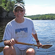
They loaded up our gear, Carl’s beautiful wood / fiberglass Old Town Canadienne and the two canoes we’d rented, and drove us up to the end of the Gunflint Trail. There we put in at the tip of the long, narrow south arm of Lake Saganaga, one of the BWCAW’s biggest and prettiest glacier-scoured lakes.

We paddled a couple of miles north up the narrow, river-like channel and then into the huge expanse of Big Sag itself.
Then it was west for about six miles across the widest part of Saganaga, skirting its numerous islands and crossing the international border. Once we entered Cache Bay, we had to register with Canadian Customs, letting them know where we were headed and for how many days.
 As we paddled away from the rangers’ island, the wind picked up and it started to snow—something I’d only once before encountered up here in June. Luckily, paddling into the wind generated enough body heat to stay quite comfortable…for a while. But soon, the piercing cold was conspiring with high winds and some nasty two-foot waves to deny us much headway, so we found a good landing spot on the lee side of a small island, and built a fire.
The wind kept pounding us for the next couple of hours until, finally, we were able to make a run for it to the nearest decent campsite.
I thought of all the millions of footsteps that have followed in theirs over 75 years.
At the time, officially-designated campsites in the Quetico weren’t shown on the Fisher maps, so we scouted our own site and, hurried by pending nightfall, quickly reacquainted ourselves with the various roles and tasks it takes to set up camp, prepare a meal and protect our food pack from bears.
I shared a tent with my brother-in-law, Carl. Thank goodness neither of us is a super-loud snorer. Nonetheless, it proved to be another long, miserable night, for, once again, the temperature kept dropping, this time to well below freezing.
My ultra-light sleeping bag, with its scant one inch of loft and a rating for about 50 degrees, came up short—or should I say thin—for me, even wearing every stitch of clothing I had. At dawn’s first scant light, still shivering in fetal position, I looked enviously over at Carl, tucked in his brand new LL Bean, five-inch-thick, zero-degree-rated goose down sleeping bag, blissfully sawing wood. It was all I could do not to either crawl in there with him…or punch him!
Next morning, we had breakfast and broke camp rather leisurely, and then paddled west toward Silver Falls, where we made several small portages before entering the very southeastern tip of the narrow, twelve-mile-long Lake Saganagons. (Indeed, its name is that similar to Saganaga’s.)

ETCHED IN STONE AND GLASS
About three miles up the north side of Saganagons, we scoured the irregular shoreline for the legendary portage. In the Quetico, portages are not clearly marked with Forest Service signs as they are in the BWCAW. So it took a while, but we finally spotted it, tucked behind a point that looked like an island. At last, this was it.
I’ve always been a sucker for all things mystical, especially if they involve ceremony. I felt an immediate reverence for this place we were about to consecrate, picturing my dad and his friend standing there, dirty and exhausted, celebrating their success blazing their way across to the other side of the peninsula. And I thought of all the millions of footsteps that have followed in theirs over 75 years.

We paused for trail lunch before starting out across the 52-rod—about 300 feet—trail.
I dug out the small packet of Dad’s ashes I’d filched from the plastic-lined boxful we got from the crematorium. As we slowly retraced my father’s steps, I scattered his ashes here and there, saving some to anoint the lake on the other side.
 As we walked back, I scouted the surroundings for the best place to bury the glass plaque and the remaining six medallions. I spotted a rock outcrop with a distinctive, linear groove. Following that line down to the point where it receded beneath the soil, I measured off a few feet past that and dug a hole in the spongy, peat-like earth. And there I carefully laid the glass plaque and six medallions.
After I solemnly replaced and tamped down the soil, we gathered on the trail. There was no question that Dad’s presence was felt. Each of us who felt the inclination offered heartfelt reflections about him and about the extraordinary experience we were sharing. Some read or recited poems; others simply offered their memories of Dad. I shared one of my favorite T.S. Eliot quotes from his Four Quartets:
“We shall not cease from exploration, and the end of all our exploring will be to arrive where we started and know the place for the first time.”We made camp that night on a lovely island not far from the portage, and laid over there for one more day before heading back home.

Our paddle back across the border was much more tranquil than the one getting to Saganagons—and no snow this time. I think we all felt a sense of accomplishment, as 50-somethings, having proved our mettle against the challenges of the wilderness, albeit for just five days.
And I felt I’d done my father proud, acknowledging a part of him I’d barely known, but came to greatly admire and respect. I realize it’s pure romanticism, but I’ve filed a detailed description of the medallions' burial site, complete with map and photos, with my will.
My hope is that one of my antecedents—who knows how far into the future—might learn of this tribute through family lore, and mount their own quest to find Oscar Willius’s and Bob Clough’s portage and excavate the buried medallions.
Call me a dreamer; I guess it's in my blood.